Plan · Brief · Track · Relive

Your Tour du Mont Blanc Companion

Plan your stages, get daily morning briefings, navigate with offline maps, and track every step. One free app from start to finish.

Open the free planner Open in browser
See Features ↓
165.7 km of trail
59 possible stopovers
+11,340 m ascent
Stage Planner

Your TMB, your pace

No hiking app plans your TMB for you. Set your days and fitness level — the algorithm splits the trail into optimal stages across refuges, gîtes and rifugi. Or go manual with rest days. No spreadsheets, no guesswork.

Try the Planner
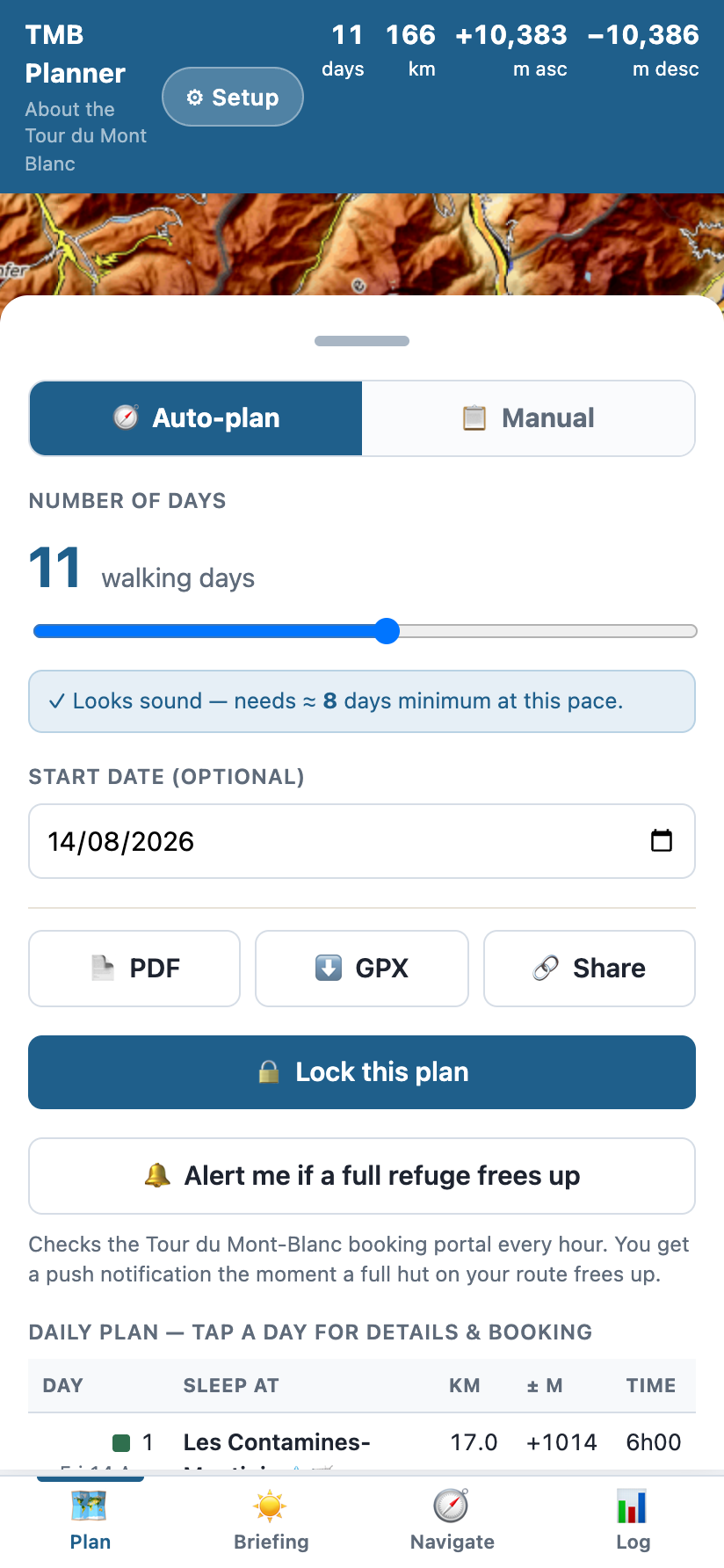
Planning screen: an 11-day Tour du Mont Blanc with live hut availability
Morning Briefing

Wake up, check, walk

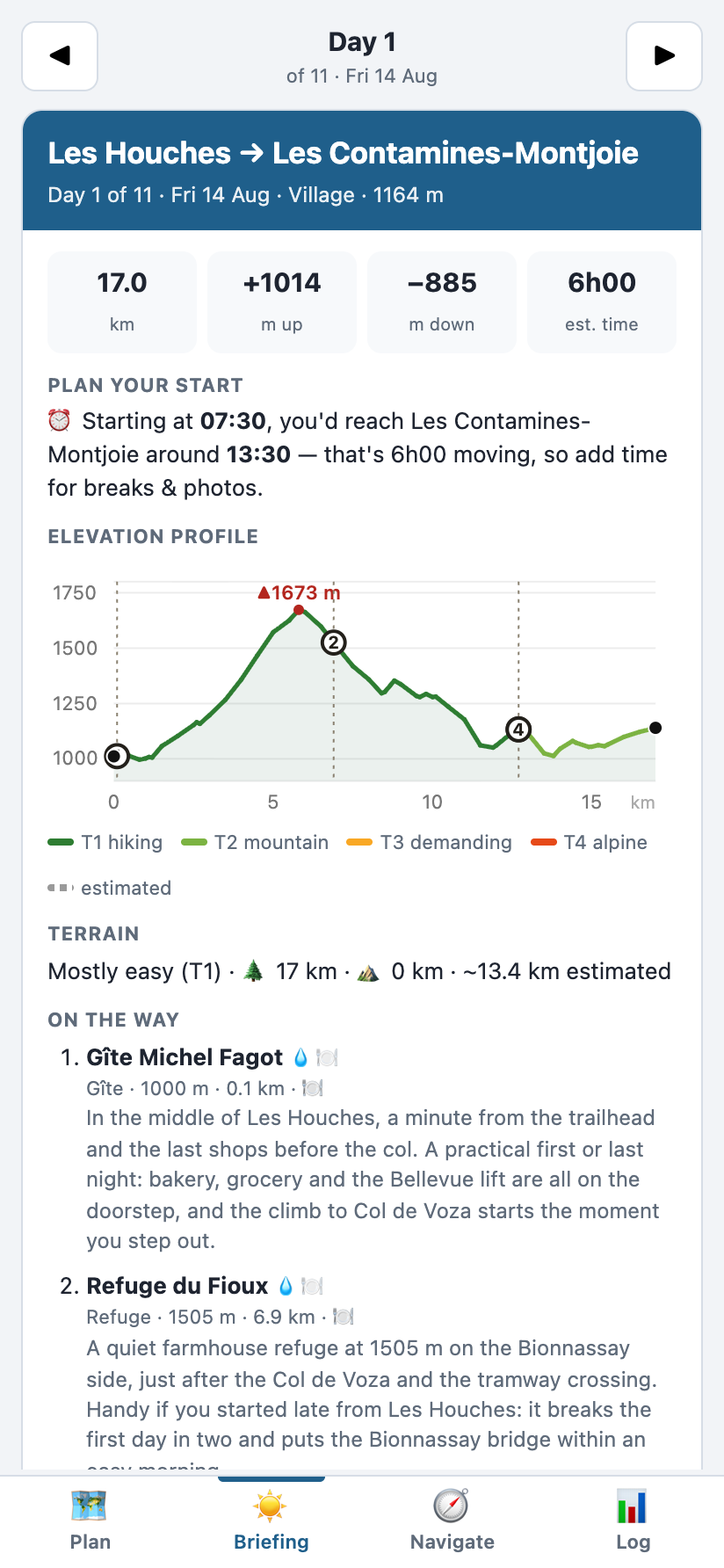
No other app gives you this. Each morning: today's distance, elevation, weather, water points and key waypoints — plus your booking reference. One screen, ready to go before you lace up.

Morning briefing: distance, climb, terrain and the day’s weather
GPS Navigation

Never lose the trail

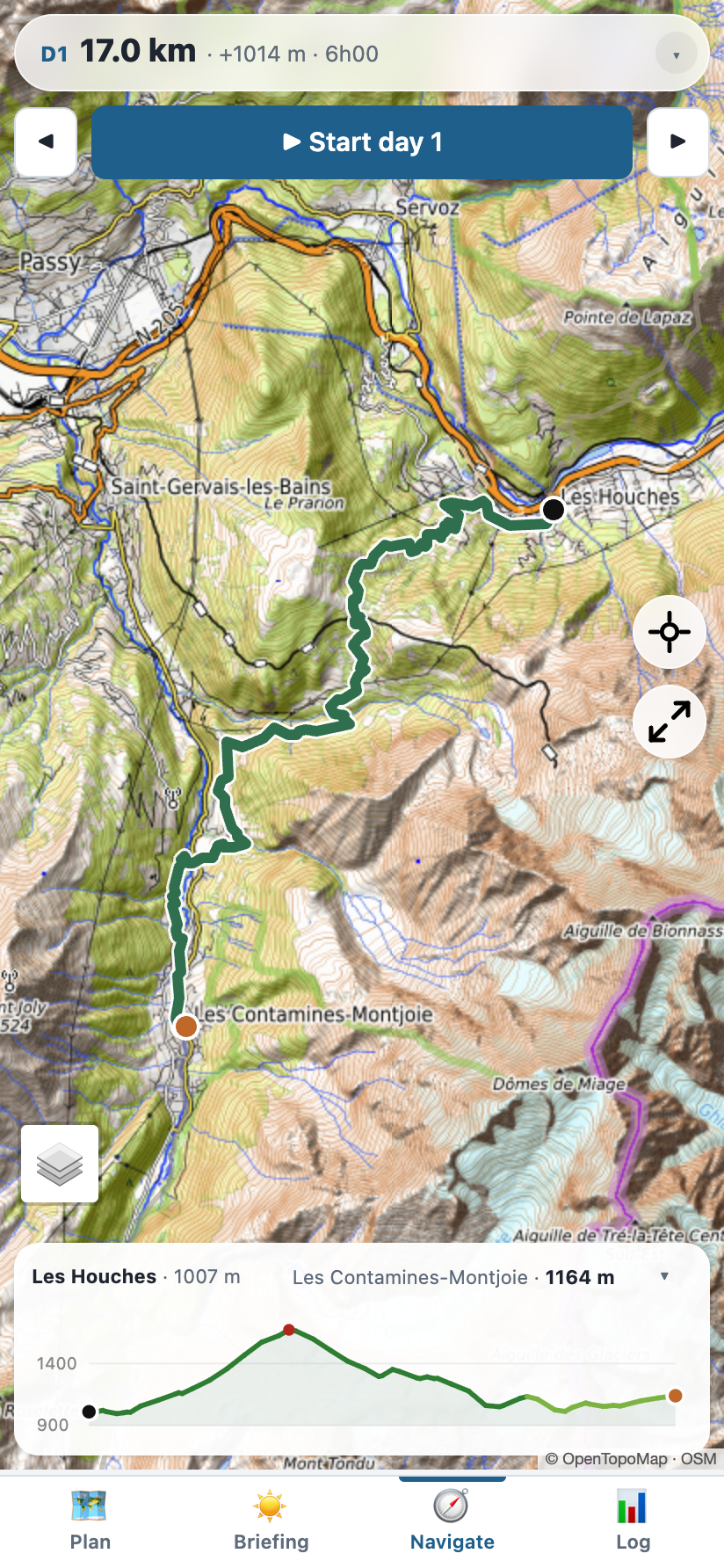
Your position on the TMB in real time — with direction arrow, off-trail warnings, and distance to your next stop. Full topo map with contour lines works without signal. Battery-saving mode built for multi-day use.

Navigation with the offline topo map and live position
Trek Log

Your trek writes itself

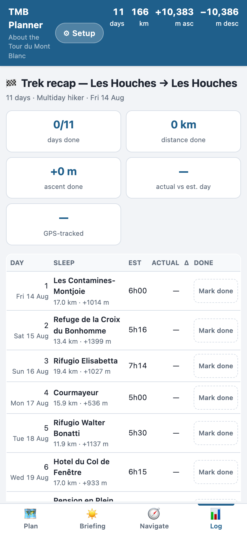
Mark arrivals, track actual vs. planned times, and see your daily stats build up. Distance, ascent, and duration logged day by day — your TMB diary in numbers, without writing a word.

Trek log: days done, distance and climb so far
⛰️

Elevation Profiles

Every stage color-coded by steepness with technical sections highlighted.

🏠

59 Stops Detailed

Including the gîtes, auberges and rifugi other apps miss. Booking links, distances, facilities.

📤

GPX Export

Download your planned route or recorded track as GPX. Share with friends or load into any GPS device.

🔔

Cancellation Alerts

Refuges full? One tap watches every night of your plan. Availability is re-checked every hour and you get a push notification the moment a spot frees up.

Know Before You Go

Season
June – September
Snow on northern passes until mid-June. Book refuges months ahead — they fill up fast.
Duration
10 – 16 days
Trail runners do it in 5. Most hikers take 12–16 walking days plus rest days.
Difficulty
Hard — technical
Scrambling, chains, exposed ridges. The north is significantly harder than the south.
Distance
165.7 km · +10,383 m
A loop from Les Houches through France, Italy and Switzerland. 59 places to sleep, 40 of them bookable online.

I built RandoNav because I couldn't find a single app that actually plans the TMB for you. Every tool out there is generic — made for any trail, good for none. This one knows every refuge, every gîte, every water point. It's the app I wished I had on my own TMB.

— Roel, hiker & developer

From people who walked it

Pulled up tmb.randonav.app on my phone, saw my blue dot right away, and realized I'd missed a turnoff. Worth its weight in gold.
Sanne
Used tmb.randonav.app to prep our stages before hitting the Alps, and it kept our group completely aligned on daily elevation profiles. Clean, precise, and straight to the point.
Martina
Super fast loading times even on weak 3G roaming in the French/Italian valleys. A small download option for offline GPX layers would make it the ultimate 10/10 tool.
Camille
Cleanest maps for the TMB I've used yet. Respect to whoever coded this.
Lars
Finally, a trail app designed by someone who actually hikes! No sign-up walls, no bloated menus, just pure, fast navigation that loads instantly when you have zero signal.
Guillaume
The minimalist design is a breath of fresh air. On the trail my brain is fried and I just want to see where I am, how far the next refuge is, and the profile ahead. Nailed it.
Elena
Runs super smooth on mobile. Doesn't completely fry your phone battery either, which is usually the curse of web-based mapping tools in the mountains.
Thomas
The elevation tracking relative to where you actually are on the route is so well implemented. No more guessing 'is that final ridge the last one?' — you can see the reality on the screen.
Jeroen
Passed a couple of struggling hikers at the refuge who were wrestling with a messy paper map and a dying generic app. Showed them your site and they bookmarked it instantly.
Matthieu
If you're heading to Corsica or doing the Tour du Mont Blanc, scrap the heavy map apps and just keep a shortcut to these on your home screen. Absolute game-changer.
Sarah
No fluff, works offline when it matters, and keeps you on the right path. What else could a thru-hiker ask for?
Florian
Absolute perfection. Please make one for the Haute Route next!
Anouk
🏔️

Refuges & Accommodation

All 59 stops with altitude, facilities and booking links.

🥾

The 16 Stages

Distances, climbs and walking times for every fitness level.

📖

Planning Guide

How many days, north or south, booking and the best season.

Ready to Plan Your TMB?

Free, offline, no account needed. Works on any phone.